TOUR COSTA PARADISO – VIGNOLA
by Mario Piga
extracts from the bookValledoria, Badesi, Trinità and Aglientu
SENTRIES OF THE GULF
From the Foce del Coghinas to Rio Vignola
Sassari, Carlo Delfino Editore, 2019 ⇒
courtesy of the Author
From La Cruzitta to Lu Strintoni or Cala Faa
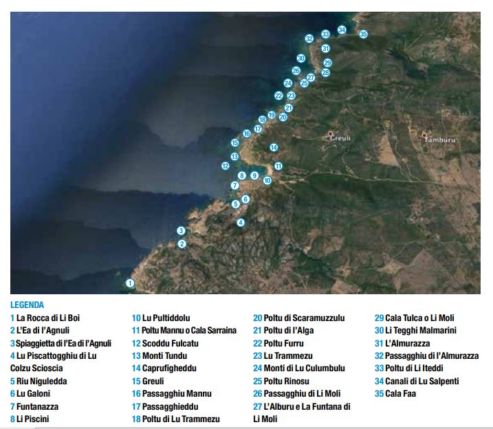
La Ena of lu Furragu (kiln spring), adjacent to this fjord, nicknamed this area thanks to its clay substrate and on-site firing.
Roofing tiles used to be manufactured here. Along the other side we come up to Rocca di li Boi (ox rock), so named because it is a sheltered place hidden from prying eyes. In the past, it was used to hide stolen cattle to be sold to unscrupulous merchants from the Island facing ours.
Ea di l’Agnuli (angel waters), Funtanazza (big fountain) Beach and the Niguledda River precede a great slope from where, on a clear day, it looks like you could almost touch Corsica. Here, too, the wind has shaped the rocks in the most disparate ways.
La Scala di li Frati (friars’ steps), a name perhaps due to its two prominent rock formations that look like “Tenores a Tasgja” (Aggius Choir Tenors) or cassock wearing monks.
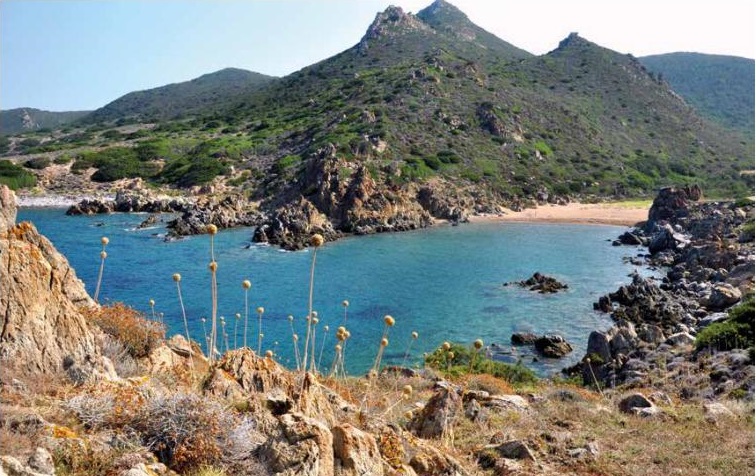
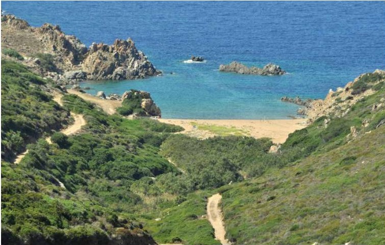
Lu Pultiddolu (little haven) or Cala Saraceno (Saracen cove), very close to Vaccagghi River, extends to the adjacent sea and the larger and better-known Cala Sarraina (queen’s cove).
These names hark back to the Saracen invasions that wreaked havoc among the Christians in the eighth century. The term “sarraina” seems to have come from a legend of that time that tells about the strange fate of a local girl. On a beautiful spring day, she had gone with friends and family to gather the bountiful gifts of nature, but she went on ahead along the shoals in search of limpets and urchins. In less than no time, some Saracen sailors who saw her from aboard a ship managed to capture her and take her to the Sultan’s court, where she was crowned queen. In memory of this Sardinian queen, the original name of this location went from Lu Poltu di Greuli to Cala sa Reina-Cala Sarraina.
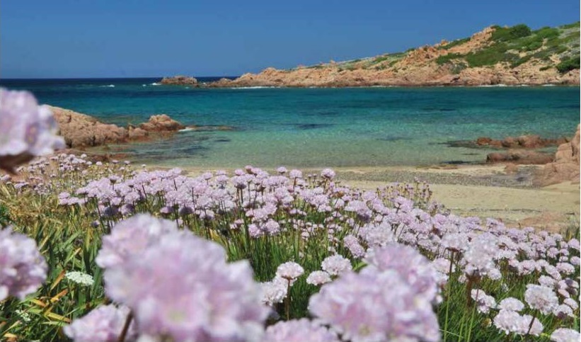
[Cala Sarraina] It is wedged in a valley adorned with flowers such as Armeria pungens (spiny thrift), Othantus maritimus (cotton weed) and Matthiola tricuspidata (three-horned stock), a wonderful natural setting that intensifies the ever-changing hues of the sea, especially in springtime. It is a canvas upon which the east wind paints streaks of colour that only Mother Nature can invent.
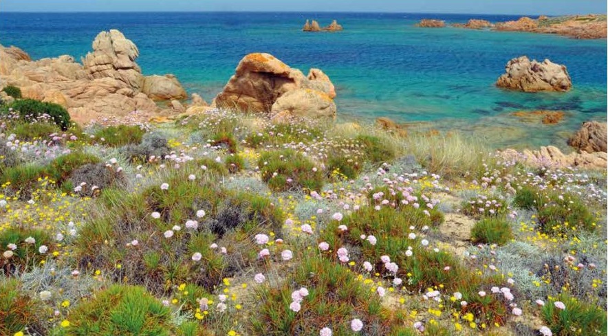
Crossing the gulf along the beach, Lu Monti Tundu (round mountain) and Lu Scoddu Fulcatu (fork cliff) appear, especially at sunset, in the middle of the entrance to the old bay.
These granite boulders resonate with fisherman’s tales. They came from Ponza, an island across the Tyrrhenian Sea, to cage lobsters and wait for sailing ships from far away to come buy them for their delicious taste. They stayed here, these experienced fishermen, in the two buildings adjacent to the beach, in the years after the war. Away from the beach, these rocks were ideal to hide their catch from human predators; nowadays, they are the location of choice for swimming feats.
It takes a little extra effort to tackle the hill in front and reach the peak of Lu Caprufigheddu (low hill) through Lu Passagghiu Mannu (great pass) and Lu Passagghieddu (little pass), ahead of the regrettably appropriately named Lu Poltu di l’Alga (rubbish bay).
There is also Lu Poltu di lu Scaramuzzulu (waste bay), where leftovers spewed from the sea gather together, next to Poltu Furru (bonfire bay), where fish are probably frequently roasted.
Li Monti di lu Culumbu (pigeon rocks) names several spots along the way carved by the wind that shelter wild wood pigeons and other types of birds. The going is easy, as the path is entirely flat, split in two by Lu Poltu di lu Trammezu (midway haven), which seemingly takes its name from its location between Cala Sarraina and Cala Faa (fava bean cove). […]
The plain of Greuli and Lu Poltu Rinosu (sandy haven) were much loved by many local families who stayed here and enjoyed the beach. These places are part of a vast clearing that ends in a steep slope, Lu Poltu di li Moli (mills heaven), to be treaded on carefully, previously called Cala Tulca (Turkish cove) by the invading because the Saracens used it as a temporary landing site. This place is so sheltered that even foxes would flee here to find escape from their hunters.
La Tana di lu Mazzoni (fox cave) is located next to Alburu e Funtanedda di Moli (mills tree and drinking fountain), a place of cool shades and shallows along Lu Passaggiu Moli (mils pass) and long-ago picnics and getaways. […]
Li Tegghi Malmarini (marble slabs), where porphyry marble is found as opposed to the more common pinkish variety, lead the way Lu Passagghiu di l’Almurazza (cabbage pass), named after its abundant Brassicaceae Raphanus vegetation, from the Greek word for turnip. […] The renown of these places is also due to their particularly delicious sea urchins, thanks to the fresh and sea water that mix here.
A vast tract of land that intersects Lu Poltu di li Iiteddi (veal haven) and Lu Canali di lu Salpenti (snake canal) is another great fishing spot during quiet, dry spells. This twisty path leads up to the entrance of Cala Faa, where a mantis-shaped rock stares at us, seemingly inviting us to enter this large and hospitable cove.
After this pleasant interlude, we approach the boundary of our municipality, amid the fragrance of the helichrysum and the banners of the Allium commutatum (island garlic) surrounding the porphyry cliff.
Our journey through the land of Trinità d’Agultu e Vignola municipality ends at Lu Strintoni (the Big Canal) or Cala Faa. After this long and impervious hike, we take a well-deserved rest amid patches of Crithmum maritimum (sea fennel), a spontaneous growth on the tip that dominates Cala Faa whose unmistakable fragrance makes it immediately recognizable.
From Lu Strintoni to Riu Vignola
From the tip of Cala Faa, you go on along a low cliff and equally fascinating stretch of coastline, in which the Rena Majori area (Municipality of Aglientu) particularly stands out. Along with many other Italian hamlets, Aglientu became independent from Tempio Pausania, the original provincial capital, thanks to a 1959 law.
Its name may originate from Latin argentu or allentu, referred to specks of silver found in a freshwater spring. However, it is more likely that it derives from agliu (white, empty), as confirmed by the various location names in the area: Montiagliu, Agliacana, Frati Agli, Agliu. This site was probably founded around the eighteenth century, as part of the neighbouring Tempio Pausania municipality, and shared its history until 1959. […]
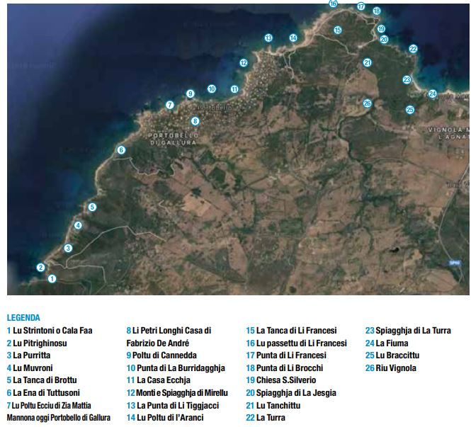
Past the inlet of Lu Pitrighinosu (the rubble), there is a wedge of thriving sea fennel. Its intense fragrance stays with me as I walk by places like La Purritta and La Ena di Tuttusoni, before the inlet of Lu Poltu Ecciu of Mrs Mattia Mannoni (the old port), now Portobello di Gallura […] singer Fabrizio De Andrè lived here, right before moving to the Agnata location adjacent to the “old port”, Li Petri Longhi (long stones).
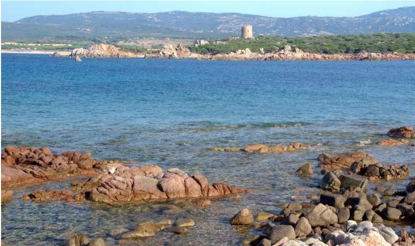
Photos by Mario Piga

